Pindar Nem VI. 40. Cited in W. Harold Mare, 1 Corinthians: The Expositor’s Bible Commentary: Romans through Galatians (Grand Rapids, MI: Zondervan Publishing House, 1976), 175.
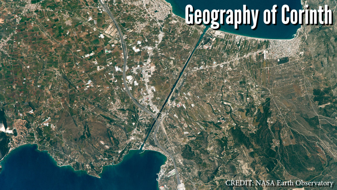
Corinth was located between two major sea ports. The ancient Greek poet Pindar referred to Corinth as “the bridge of the sea.” Instead of sailing hundreds of miles out of their way, sailors simply dragged their boats across the narrow Isthmus of Corinth (which was about 3 or 4 miles wide). Craig Blomberg writes, “Tucked between the two port towns of Cenchrea and Lechaeum, [Corinth] formed a major center of trade. The narrow isthmus on which Corinth was located, contained a path, the diolkos [literally “haul-across”], across which mariners would drag their unloaded boats, between the Adriatic and Aegean Sea, rather than sail over a hundred miles out of their way around the southern tip of Achaia.” Today, a canal cuts through the Isthmus, but this wasn’t created until 1893.
Pindar Nem VI. 40. Cited in W. Harold Mare, 1 Corinthians: The Expositor’s Bible Commentary: Romans through Galatians (Grand Rapids, MI: Zondervan Publishing House, 1976), 175.
Craig Blomberg, From Pentecost to Patmos: an Introduction to Acts through Revelation (Nashville, TN: B & H Academic, 2006), 163.
See footnote. Mark Taylor, 1 Corinthians, ed. E. Ray Clendenen, vol. 28, The New American Commentary (Nashville, TN: B&H Publishing Group, 2014), 17.

James is an elder at Dwell Community Church, where he teaches classes in theology, apologetics, and weekly Bible studies.